Glen Lednock Circular
 The sun came out at last on Sunday so we headed up to Comrie in deepest Perthshire for a walk in Glen Lednock. Comrie, whose name derives from the Gaelic for conruith meaning "confluence of streams", is a quiet little village lying at the junction of the rivers Lednock and Ruchill where they join to become the River Earn, which flows East until it runs into the Firth of Tay. The River Lednock itself runs out of Loch Lednock, a man-made reservoir about seven or eight kilometres North, and tumbles down the glen to Comrie.
There's plenty of parking so we parked near the school and walked along Dundas Street until it turns sharply into Burrell Street. At the corner, if you head straight on instead, you'll see a sign for the Circular Walk and it's pretty straightforward from there. What you get for your shoe-leather is a reasonable, four-mile walk up a wooded glen beside the river and with some detours off the main path to view a few interesting landmarks.
The first detour takes you down a wooden walkway to see the Wee Cauldron, a smallish waterfall plunging into a deep pool in the river. The second is similar but the walkway is longer and suspended in places and leads down to the Deil's Caldron, a much larger waterfall spouting out of a gash in the rocks as the river forces it's way down through a very narrow gorge. Legend has is that the Deil's Caldron, or Slocha'n Donish in the Gaelic, was the favourite haunt of a brownie called Uris-chidh who enticed its victims down into the huge natural pothole where they would drown (obviously).
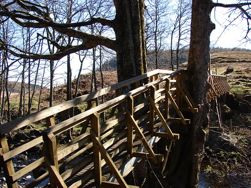 Shaky Bridge
Just up the glen a bit from the Deil's Caldron, there's a steep path off to the left leading up to the top of Dun More with its 72' high Melville Monument. The monument was built in 1812 in memory of Henry Dundas, the first Viscount Melville, who was once the Home Secretary and Keeper of the Privy Seal of Scotland, among other offices. It's worth the climb as the views over Comrie, Strathearn and the Ochil Hills are very good as well as the views up the glen towards the peaks of Ben Vorlich, Ben More and Stob Binnean. If you don't fancy the steep path, then there's a much gentler route to the top about a mile or so up the glen. It's certainly the easy way down as well and once you're back on the road, you'll see a path leading off down towards the river, which is where you cross over and begin the return journey down the other side of the water.
The bridge across the Lednock is called the Shaky Bridge, one end of which passes through, and is wholly supported by, a huge sycamore tree. It's not very shaky though and I suspect the name derives from Comrie's old nickname of Shaky Toun because of its lying on the Highland Boundary Fault and being subject to the various earthquakes and tremors common to that area. If fact, the world's first seismometers were set up in Comrie in 1840.
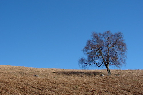 One Tree All Alone
The walk back down the glen passes through open fields, with a few trees dotted around, and then into Laggan Wood and on back down to the town. There are some good views of the Melville monument from this side of the glen as you wander downstream.
With some time to spare we headed into Crieff for a walk along the banks of the Earn but we got a bit lost trying to find somewhere to park and by the time we'd got sorted out, our motivation had gone. I suspect we'd have been better off driving up Glen Lednock instead as it looks as if you can park just beneath Loch Lednock and walk up to the 133' high dam. Maybe next time!
I've compiled a collection of the route and waypoints on Windows Live Maps (see link below).
Windows Live Collection: Glen Lednock Circular Walk


1 comment:
The shaky bridge used to be shaky, back in the 1970's. It was higher, too, and there was some disappointment when it was rebuilt as it is now. Shaky bridge because of shaky toun ? Err... no.
Post a Comment