Showing posts with label walking. Show all posts

Monday, August 21, 2023

Mossneuk Wood

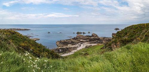
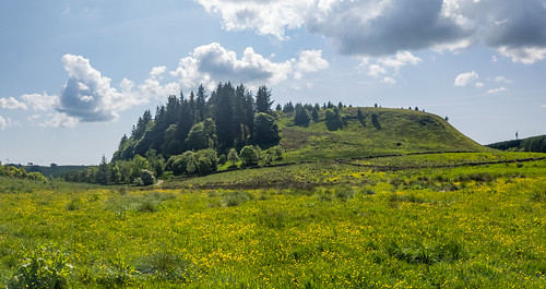
The weather brightened up yesterday so we went for a local walk over to the wooded path around Neilston View Car Park, which is in Mossneuk Wood on the Lochliboside Hills. I'd never heard the name Mossneuk used until yesterday when I had a shot finding out what the wood was called.

Anyway, the walk involves a trudge, and I mean trudge, up Station Brae to get over the railway line and onto the hillside. Yes, you could park in the car park but where's the health gain in that?

The Route

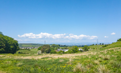
On the way up Fereneze Road, you get a good view back across the Levern Valley to Neilston, including Crofthead Mill and Neilston Pad in the background.

Crofthead Mill and Neilston Pad from Fereneze Road

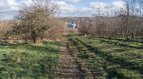
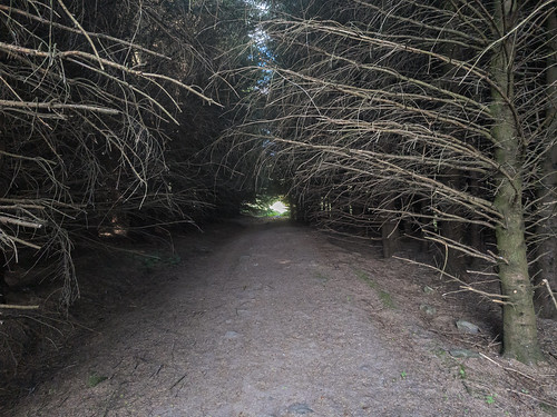
Once you're up there, it's all nice and pleasant woodland walking altough it can get a bit muddy if it's been raining but the going was good today. It looks like a lot of the trees were planted quite recently but there are fair number of older ones as well.

Mossneuk Wood, looking towards Knockenae Hill

When you take the path off Fereneze Road, fight your way through the nettles to the main track and turn left, downhill. Follow the track down and round to the right and it'll start to run parallel to Lochlibo Road. If you like foraging, there are lots of raspberries canes and blackberry bushes on the edges of the track here in the right seasons. The blackberries were starting to ripen so that probably explains why this walk took a bit longer than usual.

In Mossneuk Wood 

You might also see a rabbit as there are loads of signs and deer as well, although we've never seen one here. There were quite a few Peacock butterflies around and we spotted a single Small Copper butterfly but my phone is no good at close-up shots. Earlier in year and there are usually loads of Ringlet and Meadow Brown butterflies as well. Lorna thought she saw a Skipper (no idea which and it's not really their normal range) but it...skipped. More likely another Small Copper.

If you keep on the track until it starts to turn uphill, you'll also see that it continues on through the trees and you can take that as an optional extension thatbtakes you to the out edge of the wood. In that field is a large electricity pylon so, if you're averse to getting close to them, then avoid that. If you do take it, then keep to the edge of the wood and you'll find the path back through to join back with the main path.

In Mossneuk Wood across from Neilston View Car Park.

Otherwise, just keep heading uphill and back until you see the path leading up to Neilston View Car Park and take that. From there, you can cross over Fereneze Road, go though a gate and walk a short loop round the upper part of the wood where you can get some nice views up onto the braes above. Once back at the gate, cross over the road to the car park and head back downhill again.

The track will eventually take you back to where you started and There are more photos I've taken  onto Fereneze Road again, from where you can head back from whence you came. There are some more photos I've taken up there here:

Lochliboside

Monday, August 14, 2023

The Kissing Tree on Fereneze Braes

The walk from Neilston up to the Kissing Tree on Fereneze Braes via Killoch Glen is just over five miles there and back (six if you return via Gateside), which should take you about two hours plus whatever time you spend malingering at the tree, enjoying the views or any wee rests as you go.

A landscape photo showing a lone tree overlooking a cityscape.
The Kissing Tree

The walk starts and ends in the village of Neilston, which is well-served by rail from Glasgow Central Station and there are regular bus services from both Glasgow and Paisley. There’s also a decent-sized, free car park by the railway station. There's also an option to return via Barrhead, which might suit some using public transport.

The route takes you down to the start of Killoch Glen, a stunning little gorge with waterfalls and pools, and up onto the beautiful area of woodland and heathland that is Fereneze Braes with views out over Paisley and Glasgow.

The best time to do the walk is in the spring or autumn, when the weather is mild and the leaves are changing colour. However, it can be done all year round, as long as you’re prepared for the variable Scottish weather conditions. The bracken and gorse at the side of the path can get very thick over the summer and can obscure the way, which can get a bit tricky in poor weather.

The “Kissing Tree” is a name attributed to a rather windswept Hawthorn tree that stands alone on the top of the braes. I don’t think it’s the Kissing Tree mentioned in old texts of the area (see the end of this article) as that was supposed to be well-studded with nails and this one isn’t.

Part One - To Killoch Glen

  1. Starting from the old bank building, currently Neilston Development Trust, on Main Street turn left and walk along Main Street, past the war memorial and shops, then turn left into Broadlie Road.
  2. Follow Broadlie Road all the way to its end and go through a kissing gate onto a small track.
  3. Follow the track, curving down and to the left and you’ll see Crofthead Mill ahead. It’s an old cotton spinning and thread-twisting mill founded in 1792 but, while it's no longer a mill and is a bit dilapidated-looking, it’s still a busy industrial area. Follow the track in that general direction until you see a gap that will let you out onto Holehouse Brae.
  4. Head down to the bottom of Holehouse Brae and cross over Lochlibo Road, but be careful as it can be pretty busy with fast-moving traffic. Then head up Station Brae to cross over the Glasgow-Kilmarnock railway line.
  5. At the top of Station Brae, turn right onto Ferenze Road and follow that until you reach the bridge over the Killoch Burn, just before the water treatment plant.

A landscape photo showing a little waterfall on a small stream surrounded by trees.
The Killoch Water

Part Two - Killoch Glen to Fereneze Braes

  1. After looking at the old, broken bridge just upstream, take the footpath on the right hand side of the burn and follow it up through the glen, past the waterfalls and pools, until you see the signpost for Barrhead. The route up the glen is quite steep but there are a few benches on the way if you need a wee rest.
  2. Once at the signpost for Barrhead, don’t be tempted to ignore it and head straight up the side of the nearby fence as, while it is the shorter route, it’s pretty hard going and better kept for when you’re coming back down.
  3. Follow the Barrhead path until you’re clear of the trees and up on the edge of the moorland. There are some steps involved and another signpost so keep along the path until you see a route leading through the fence and onto the hillside - you should be able to see a small cairn in the distance, so head for that.
  4. Once you get to the cairn, the view back towards Neilston and up the Levern Valley is quite good and it's a good excuse for a wee rest. You should also be able to see your goal, the Kissing Tree, off in the distance across the moorland.

A landscape photo looking across some bleak moorland to a lone tree on the skyline.
A Lonesome Hawthorn

Part Three - To the Tree

  1. Follow the track in the general direction of the tree until you reach an old stone wall.
  2. There’s a break in the wall, so go through that and follow the line of the wall. It’ll eventually turn right so keep on and, when you reach the obvious hole in it just past where it joins another wall, go through that.
  3. The path up to the tree should be obvious from here and, once you’re there, there’s a few potential sitting spots to have a packed lunch beside it. There’s usually a rope swing hanging from the branches if you’re feeling more adventurous.
  4. Just past the tree, there’s another cairn and there are some fine views to be had out over Paisley and the surrounding area as well as over Glasgow.

Keep an eye out for Kestrels on the braes. We've seen one every time we're been up there, once even perching in the tree itself.

A photo of a Kestrel, hovering in the sky.
A Kestrel, hovering above the braes

Part Four - The Return to Killoch Glen

  1. Walk back down the path that got you here but, instead of going back through the wall, continue on the path until you get to a kissing gate a little further on and go through that.
  2. When you reach a signposted junction, either take the right turn for Killoch Glen along a wooden walkway, which is the way the rest of this guide is going, or continue on the path to Barrhead and that will eventually take you down to Graham Street in Barrhead and very close to the railway station.
  3. Take care on the walkway as some of it is in poor repair and you might as well just use the wee track beside it if it’s dry. The route takes you back up the Levern Valley above the little hamlet of Gateside.
  4. You’ll eventually come to a set of wooden steps leading down the hillside a bit so take those and, at the bottom, turn right back onto the path again.
  5. You’ll end up back at the top of the fence, the one I suggested you avoid following earlier on the way up, that leads back down into Killoch Glen so take that and then turn left when you reach Killoch Glen and follow the path back down to the road.
  6. You can then simply reverse your steps back to the start from Part Two above or, if you like a more circular walk, then read on.

A landscape photo of a small stream running under a little stone bridge.
The Levern Water at Gateside

Part Five - To Neilston via Gateside

  1. Turn left and continue along Fereneze Road, past the water treatment works, to Gateside.
  2. Turn right into Gateside Road and follow that windy little road, which crosses a bridge over the Levern Water, often the haunt of Dippers and Grey Wagtails, until you reach Lochlibo Road.
  3. Cross back over Lochlibo Road, again watching for traffic as it is busy, turn right and after a short distance, turn up Donnie’s Brae and follow that to the top.
  4. When you reach the top of Donnie’s Brae, cross over Neilston Road, turn right and head back uphill to Neilston. Take great care crossing the road here as it’s on a bit of a blind approach to traffic coming down from Neilston.
  5. Follow the road into Neilston and you'll eventually get back to the old bank, where you started.

This is a great walk for those looking for a wee bit more of a challenge than the average countryside walk provides. The views from the top of the Fereneze Braes are stunning, and the glen is a beautiful place to walk through. Here's the route:


The Kissing Tree

Here's an extract from A History of the Parish of Neilston by Dr. David Pride…

"The Kissing Tree. —From Killoch Glen across Fereneze Braes to Paisley there is, and has been from time immemorial, a footpath, or right- of-way. From this path on the top of the hill on an early morning in summer, when the sun's rays are bursting athwart the broad expanse below, one of the finest and most extensive views is to be had of the surrounding country, a view which will well repay the early riser for his trouble. Formerly the " Kissing Tree," which was well studded with nails, stood on the crest of the hill by the side of this walk, connected with which tradition has it that the swain who succeeded in driving a nail into its gnarled trunk at the first blow was entitled to claim the osculatory fee. The tree has, however, long since disappeared, carrying with it the nailed record of many victories."

You can read the full account of this entertaining walk here (it’s nearer the bottom of the page):


…and there’s a poem about it as well…

The Auld ‘Kissin' -Tree

"THEY are gone now for ever, those dear, happy days
When I climbed the steep side o' the Fereneze Braes,
And gazed on the scenes, so lovely to see,
As I stood on the hill by the auld "kissin'-tree."
The fields were a' green, and the flow'rs were a' fair,
For the beauties o' Nature had found a hame there;
But those lovely scenes, what were they to me
Compared wi' the stem o' the auld "kissin'-tree"?
For its trunk wis well pierced wi' nails a' aroon'
By the laddies from Barrhead an' auld Neilston toon,
And even frae Paisley, light-hearted an' free,
Some cam' ower the hills tae the auld "kissin'-tree."
How oft hae I watched the lad wi' his lass
Ca' a nail in its trunk before he wid pass,
And then turn aboot, wi' a bright smile o' glee,
To taste her sweet lips by the auld "kissin'-tree."
But noo it is gone, an' I mournfully stare
At the place whaur it stood, for I see it nae mair;
An', wi' a sair heart and a tear in my e'e,
I think on lansyne an' the auld "kissin'-tree."

Hugh Caldwell, circa 1840

A landscape photo looking along a boardwalk trail towards some trees and the valley beyond.
Heading back to Killoch Glen

Killoch Glen

This picturesque little glen and the burn are long associated with witches because, at low water, the numerous pot-holes or rock-cut basins have worn into one another, giving the area an unusual shape. Witch-related names have been attributed to some of these shapes - the smoother parts between the holes are her “floor,” and her “hearth”; while the cavities, according to their shape and depth, are her “cradle,” her “water-stoups,” and her “grave”.

“Down splash the Killoch’s wimpling wave,
As through the glen the waters rave,
Far o’er the witch’s eerie grave,
Frae crag to linn,
Yon beetling rocks, they wildly lave,
Wi’ gurgling din.”

This song by James Scadlock, an engraver born in Paisley in 1775, is a bit cheerier (only a bit though):

“The sun's now setting in the west,
And mild's his beam on hill and plain,
No sound is heard, save Killoch Burn
Wild murmuring down its woody glen.”
“Will you gae to Glen Killoch, my Mary,
Whar the burnie fa's owre the linn;
Its murmurs are dear to me, Mary,
When borne on the saft-brcathin win.”
“Hark the winds around us swell,
Raving doon Glen Killoch dell,
Where aft wi thee, my bonnie Bell,


Monday, July 31, 2023

Identifying the Landscape

Have you ever been out walking or climbing and taken some photos of what you think is some stunning scenery but have no idea what hills or mountains you're looking at?

Thankfully, there are a few resources that can help with that as long as you know where you were (or are) while looking. If you don't know where you are then I'd suggest you're lost and that's a whole different problem.

How to Find Out Where You Are

If you need to find your current GPS coordinates, then that's easily done (assuming you have a GPS-capable smartphone) using Google Maps. Google have a simple guide on how to do it using a computer or smartphone here: https://support.google.com/maps/answer/18539?hl=en

There are loads of free apps that will do much the same, although most are supported by ads. A compass app is also useful, especially if you're lost.

If you have a paper map and compass, then there are some decent guides on how to use those here:

If you don't have a smartphone or a paper map and compass, then you really are lost I'd usually suggest finding a watercourse and following it downstream in the hope that it'll hit a road. I've never been lost in a desert or jungle and that strategy won't help in either of these scenarios so your best bet then is to use the sun (climbing a tree is optional but watch out for dragons):

Identifying Them Thar Hills

Okay, you know where you are (or were) and we can move onto identifying what you're looking at. Again, a smartphone or computer is the best way to do this but it can be done using a paper map and compass like we did years ago and I'm not going to describe how to that here.

These days, if I'm outdoors I'll try the PeakLens (Android) or Horizon Explorer mobile apps (Android and iOS). Sadly, the PeakVisor app is iOS-only and the PeakFinder app is not free. All of these apps will try and identify what you can see via your device camera using augmented reality.

If you've taken some photos and are enjoying a cup of hot soup or coffee after a day on the hills and are wondering what you're looking at, then here are a few online apps that can help identify any mountains, peaks or hills in them:

  • PeakVisor Explorer - the app isn't available for Android but you can search here.

    Panorama from Neilston Pad

  • PeakFinder - the app isn't free but the web app will let you search by name or GPS coordinates.

    Panorama from Neilston Pad

  • Generate a Panorama - lets you generate a panorama given location and direction.

    Panorama from Neilston Pad


Saturday, July 01, 2023

Walking on Gailes Beach in Irvine

Gailes Beach in Irvine is a place we regularly go for a walk or just to chill out. It's only 30 minutes drive away from Neilston so is much closer than Fuerteventura or Crete. Okay, those may have much nicer beaches and are generally warmer than Irvine but they're not just down the road.

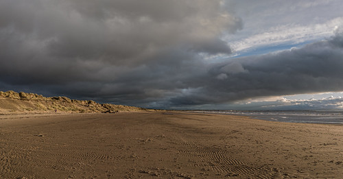
A photo of a wide, sandy beach with dunes on the left.Gailes Beach

Gailes Beach is roughly five miles long and runs from Irvine to Barassie. It's very flat and sandy, backed by a long series of sand dunes, and is kept pretty clean and tidy. It's easily reachable by car and there are regular bus and train services from Glasgow so it can get quite busy in the Summer. That said, walk a few miles along the beach and it's much quieter, with only the odd stalwart dog walkers and horsey types. We tend to do just that as there are some well-sized blocks you can sit on about half-way along, ideal to take a break at and enjoy the scenery.

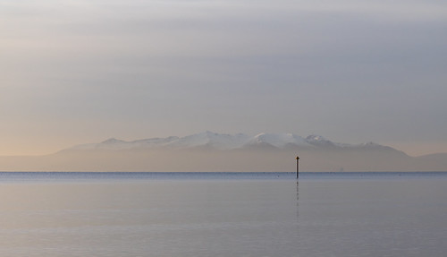
A photo of a seascape with snow-covered mountains in the distance.A Snow-covered Isle of Arran

There are some splendid views to had from the beach. You can see Barassie and Troon to the South, Ailsa Craig and the Isle of Arran lie just offhsore. You can also watch the small fishing boats and larger ferries that ply the Firth of Clyde as well as a fair range of birds that use the beach and sea as a source of food. If you stay long enough, then there are some stunning sunsets to be seen as well.

A photo of a seascape at sunset.Ailsa Craig at Sundown

There's often an ice-cream van near the coast guard-come public toilet building, some very nice coffee shops and cafés on the edge of the harbour if you need some refreshments and, if you're looking for a meal or a drink, then there's The Ship, which does some very decent bar meals.

There are more photos taken on Gailes Beach and Irvine Harbour here:

A photo album containing photos taken in Irvine

Thursday, June 22, 2023

Recording My Walks

Walking is good for you and helps keep you healthy and fit so I thought I’d list a few useful online and mobile resources that can be used to track what you do and how you’re doing.

A Bit Of History

An image of a Fitbit One step tracker. Back in 2013, when my doctor told me my blood sugar was too high and I was on the way to getting type 2 diabetes, Lorna got me a little Fitbit One tracker and I started trying to hit the 10,000 daily steps target (as well as cutting down on the sugar intake). That, along with the MyFitnessPal app to track my calories and moving to Neilston for the cleaner air and the countryside, kept the diabetes at bay.

The Fitbit One's downfall was twofold.
 
Firstly, it relied on a being in a wee rubber case with a clip that was used to fix ito your pocket, belt or whatever. It was easily lost and I did that a few times. It connected using Bluetooth so I managed to find it in the garden a few times but eventually I lost it, I think on the train. That said, I messaged Fitbit about it and they kindly sent me a replacement.

Secondly, the battery was non-replaceable, well at least not easily, so it eventually died as all such  things do. Built-in obsolescence is a bitch!

As a keen photographer, I was already using my mobile phone and other things to record my GPS tracks so I could geotag any photos that I’d taken on my non-GPS-enabled dSLR camera. It was quite early days for doing that and those apps are mostly gone now, some killed by Android updates, some just let die off by developers, overtaken by what we have now…progress.

I even wrote a blog article on how I geotagged photos back then - How I Geotag My Photos.

What I Use Now

I currently use a Fossil hybrid smartwatch that takes a cheap, replaceable battery that lasts about six months, and the Fossil Smartwatches App to track my steps (and other things) but if I want to track a walking route, then I use the Runkeeper app.

I’ve used the Strava app before with good results but it produced very dodgy GPS tracks on my previous phone so now I track using Runkeeper, then download the GPX file from that and upload it to my Strava account. That way I have two online copies of the data. I can also use the GPX file to geotag photos taken with my dSLR camera.

Mobile App Suggestions

Here’s a list of what I suggest you look at, if you want to dabble in step recording/walk tracking. I’ve tried a fair few such apps over the years and all of the following have apps for both Android and iOS and are either free or offer free accounts that will do the job for most people.

The Google Fit app icon. Google Fit

If you have a Google account, then this free app is well worth checking out. It’ll let you record steps, track workouts, set goals, set a pace for your walks, track your respiratory rate, and check your heart rate. The last two features use your mobile phone camera, no add-ons needed. You can even manually add and track activities, hydration, meals, weight and blood pressure readings as well.

It can also be linked to other apps to share data. For example, it gets sleep data from my Fossil app.

The Samsung Health app icon Samsung Health

If you have a Samsung Galaxy mobile or smart watch (and a Samsung account), then this free app is another option worth looking into. It’ll let you record steps, track workouts, set goals, . You can even manually add and track activities, sleep, meals, hydration, and weight readings as well.

The Runkeeper app iconRunkeeper

You’ll need to sign up for a free account to use this app but it’ll do almost everything you need to track your walking, running, cycling, etc.

The web view will let you see more information, manually add or even edit activities (including the route), create a route that you can share, and it’ll let you export your activities to GPX or KML (Google Earth) files.

There’s also a social aspect to the app as it’ll let you decide who can see your activities

The Strava app iconStrava

Again, you’ll need to sign up for a free account to use this app and it’ll do almost everything you need to track your walking, running, cycling, etc.

The web view will let you see more information, manually add activities, and it’ll let you export your activities to GPX files.

As with Runkeeper, there are social aspects to the app. You can follow other users as I do and it’ll even recognise when you’re walking together.


Lastly…if you have an Apple iPhone, then you might want to try the Apple Fitness app but it doesn’t get great reviews and Apple is really pushing their subscription-only Apple Fitness+ app.

Sunday, June 11, 2023

A Walk from Findochty to Portknockie and Back

It was nice to be back up on the Moray coast for a week's break. We were staying in the wee village of Findochty (also sometimes called Finechty) so our first walk was from there to the neighbouring village of Portknockie.

A landscape photo showing a small seaside village from a clifftop.Findochty from the clifftop path

It's a fairly straightforward plod up to the clifftop from the beach and then follow the fairly wide path to Portknockie and on to Bow Fiddle Rock, natural quartzite sea arch, so called because it resembles the tip of a fiddle (violin if you're posh) bow. After a break for lunch sitting on one the benches near Bow Fiddle Rock, we headed back to Findochty.

A photo of a common lizard
It's a fairly pleasant and level walk with fields on the inland side and lots of fragrant and yellow-flowering gorse bushes on the cliff side. I spotted a wee Viviparious lizard sitting on top of a mole hill, probably because it was warmer than the grass, and it didn't seem to mind me pointing a camera at it. 

A photo of a Yellowhammer.As for birds, there were quite a few Skylarks nesting in the fields and lots of Yellowhammers on the gorse.

Bow Fiddle Rock and the accompanying crags and stacks had plenty of noisy Herring gulls, Razorbills, Guillemots, and Cormorants diving and wheeling around.

A photo of a natural sea arch just offshore.Bow Fiddle Rock

The distance there and back is just over four and a half miles so allow two to three hours for an easy walk and a break for a snack.


The Walking Route

Here are a few more pictures taken on the day:

A photo of coastal view.A Rocky Coast

A photo of coastal view.Moray Coast

Sunday, June 04, 2023

A Walk to Harelaw Dam

With the weather being so nice today, we had a walk up to Harelaw Dam, knowing full well that there's a nice wee coffee shop up there where you can sit outside and enjoy the view..

A photo of a reservoir with a small boat harbour in the foreground.Harelaw Dam

The route is pretty straightforward - up through the housing estate to Kingston Road, take the farm track to Neilston Pad and follow it round the back of the Pad to the car park on Harelaw Road. From there it's a straight walk to the dam.

An image of a map showing a walking route.Harelaw Dam Walking Route

There were plenty of seats outside when we got there, although the owner said they had been pretty busy earlier, so we got some light refreshments and had a wee rest watching the House Martins swoop and dive over the water. There was the occasional splash of a trout jumping as well as there were plenty of insects on the water.

A landscape photo of a tree-topped hill.Neilston Pad

The route back took us back to the car park on Harelaw Road, then followed a wee track that took us round the front of Neilston Pad and past Craighall Dam. Rather than follow the main track, we then kept going along the edge of the Pad and cut through the woods to re-join the path. From there we cut off the track again then joined a small trail that took us down through Neilston Quarry and back to Kingston Road. From there we took the road down to Midge Glen and back from there.

There were a few butterflies out today as well. We spotted quite a few Orange Tips and there were a couple of Small Heaths on the edge of the Pad.

Here are a few more photos taken on the day:


A landscape photo showing a view out over farmland and on the a cityscape in the distance.Looking out over Glasgow and the Campsies

A landscape photo showing a country road.Harelaw Road

A landscape photo of a dark woodland path with a patch of sunlight at the far end.The dark path that joins the two tracks

A landscape photo showing some woodland with blue flowers between the trees.Forget-Me-Nots on the path to Neilston Quarry


Tuesday, May 30, 2023

Lochwinnoch RSPB Nature Reserve

The Neilston Men's Group recently visited Lochwinnoch RSPB Nature Reserve, one of the few wetlands left in the West of Scotland, and had an enjoyable time. The group met at the reserve's visitor centre, where they were greeted by friendly rangers who gave us a brief overview of the reserve, the trails and what we were likely to see as we wandered around.

A landscape photo of a small loch or lake.Aird Meadow Loch

We then enjoyed a leisurely walk around the reserve as far as the new boardwalk and along to the ruins of the Peel Tower on Castle Semple Loch. One of us was in a wheelchair and we had no problem getting him along the trail and boardwalk. The trail stops at the Peel Tower but the rangers said that, funds permitting, they would like to extend it further and join up with the trail on the other side of Aird Meadow Loch, which would make it more of a circular walk.

There weren’t many waterfowl around, probably due to the time of year, but we did see a Mute Swan and what looked like a pair of Great Crested Grebes farther out on the loch. The surrounding trees, on the other hand, were pretty busy with birdlife and, even if we couldn’t see them, we could hear them well enough. Using a mobile app called BirdNET, we identified a few of them as a  Eurasian Wren, a Willow Warbler, and a Eurasian Blackcap.

The Peel Tower, sometimes called the Peel of Castle Semple or even "Defender of the Faith", was a fortified tower house built shortly before 1560 by the local Semple family, during the troubled times of the Scottish Reformation, to protect their land and property from raiders and as an impregnable retreat. It was originally built on a rocky islet in Castle Semple Loch but subsequent drainage programmes have left an embankment that now connects it to the shore.

A photo of a ruined tower.Peel Tower

There's not a lot to see from the boardwalk other than some musket ports and there's no easy way for anyone to clamber over to it and there are warning signs not to leave the boardwalk. Anyway, there was no way we were getting Billy's wheelchair over there and there was a big black Carrion Crow bobbing around, probably hoping someone would try it.
 
After a bit of standing around enjoying the pleasant weather and surroundings, we returned to the visitor centre picnic area for a tasty, à la big box that Raymond brought, salad roll lunch supplemented by teas and coffees from the visitor centre. There were even doughnuts and a cheeky Jackdaw and some wee Sparrows trying to cadge a few crumbs, although I suspect in case of the Jackdaw, a finger would have been more appreciated.

We really enjoyed the visit to Lochwinnoch RSPB Nature Reserve and had a good time wandering along the trail. We would definitely recommend it to other groups or individuals who are looking for a fun and educational day out.

A landscape photo of a large loch or lake.Castle Semple Loch

The Neilston Men's Group is a group of local men who get together regularly to socialise and participate in activities. They're committed to making a positive contribution to the local community, and believe that visiting Lochwinnoch RSPB Nature Reserve was a valuable way to learn about some of the nature and wildlife that surrounds us while taking advantage of the good weather.

Finally, the standard group shot in front if the visitor centre:

A photo of a group of men standing in front of a doorway.

There are a few more photos here:

Lochwinnoch RSPB Nature Reserve

If you’re interested in visiting Lochwinnoch RSPB Nature Reserve, then here are some more details:

  • The reserve is located in Renfrewshire, Scotland and is easily accessible by car or train.
  • It’s open all year round and admission is free, although there is a charge for parking.
  • During the Spring, you might see the Great Crested Grebes courting and in Winter you’ll likely see Whooper Swans, Wigeon and a wide variety of ducks and other waterfowl.
  • The visitor centre has toilets, a picnic area, a kids play area, and a shop that also sells light refreshments.
  • There are a variety of nature trails to choose from, including a wheelchair-accessible trail.
For more information, please visit the RSPB website:

Monday, November 25, 2013

A Stroll Round Balgray Reservoir

​Despite the weather forecast predicting a miserable day, we woke up to a sunny and seriously cold morning, all blue skied and bright, so after lunch we drove over the slightly scary road from Neilston to Balgray Reservoir in the Dams to Darnley Country Park.

Balgray ReservoirBalgray Reservoir

So, far from being drenched with rain, we had a decent stroll across the dam to Aurs Road and back again, around the edge of the reservoir up as far as Aurs Road on the other side. Not a huge walk by any standards but a decent taster as our first foray into the park.
There was a smattering of snow on the ground and wildlife sitings include a flock of lapwings, a pair of mute swans and a great crested grebe.

Mute SwansMute Swans

Great Crested GrebeGreat Crested Grebe

All images of the day are here - http://flic.kr/s/aHsjMLBsiw/show

Sunday, February 15, 2009

A Cold Afternoon At Castle Semple Loch

Sunday again and the weather isn't great but still decent enough for a stroll by Castle Semple Loch near Lochwinnoch.

Castle Semple LochCastle Semple Loch, looking towards Kenmuir Hill Temple

It's still cold so the loch was partially frozen over with a thin film of ice but that didn't stop the usual gamut of over-wintering waterfowl from enjoying the day.

Castle Semple LochA Frozen Castle Semple Loch

There were plenty of birds in evidence - mallards, mute swans, tufted ducks and goldeneye as well as the ever-present gulls. The wind was whipping over the loch surface and where it hit the edge of the ice, it produced a really strange tinkling sound. Anyway a few hours wandering in the cold here was enough and we headed back home for a warm fireside.

Tufted DuckTufted Duck

Mute SwanMute Swan


Sunday, February 08, 2009

Ardardan and Balloch

It was a cold and potentially snowy Sunday and we'd wanted to go for a walk up Ben Lomond as it looked spectacular on the Saturday, all cloaked in white. Unfortunately, it was completely hidden from view by low and freezing clouds and snow was forecast so, being sensible folks, we opted to stay closer to the ground and go for a wander along the shore at Ardmore Point, a privately owned peninsula with a nature trail laid by the Scottish Wildlife Trust, near Cardross on the Firth of Clyde.

Toffee CooNosey Toffee Coo

Unfortunately, my navigational skills were lacking on the day and I took the earlier turn off, missing Ardmore and ending up at Ardardan Estate instead. Ardardan is set in a little walled garden between Cardross and Ardmore and comprises a farm shop, garden nursery and tearoom. Not quite what we were looking for but we had a nose around anyway to pass the time. The farm shop was a bit upmarket for us, selling atrociously priced grocery items more frequently seen in the likes of Harrods or Fortnum and Mason's. The only positive thing was the fact that they sold Stornoway Black Pudding.

Of more interest to us at the time was a short woodland walk around, well a small wood. The path basically led off from one end of Ardardan, circled a small wood and came back round to the farm again. It was probably no more than quarter of a mile round but it had started snowing and seemed interesting enough at the time. On the way round we got to say hello to some inquistive Highland Cows and their calves. It's not a bad place to take kids for a few hours as they can see some farmyard animals like chickens, pigs and the "Toffee Coos" while mum and dad can edge them towards the tearoom. It also has a spectacular fountain with leaping dolphins, which looks a bit out of place among the farmyard clutter.

Drumkinnon BayDrumkinnon Bay

Deciding the weather wasn't even up to a shoreline walk at Ardmore, we drove on to Helensburgh and then up and over the hill to Loch Lomond to see what was going on at Drumkinnon Bay at the Balloch end of the loch. Loch Lomond Shores is yet another pretentious, upmarket tourist trap but it does have a coffee shop and some potentially spectacular views of Ben Lomond. Not today though as it was snowing and the Ben was completely obscured from view.

Gulls On IceGulls On Ice

With an almost grey backdrop to the loch, there wasn't much to see except some stark contrast images of snow, ice and frost and a tied-up Maid of the Loch. Oh and some gulls wandering around on an ice-floe on the water. After a suitably hot coffee and a bun, we headed home for the warmth of the fireside and the telly - brrrrr!